Symbol
- Sort condition
- Newest first
- Oldest first
- Large number of views
-
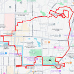
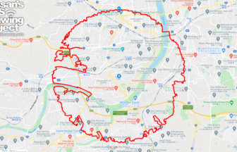
Hakodate Circle Walk 33km
The course of an equilateral circle drawn around Goryokaku✨Goryokaku was Japan's first Western-style fortress. It wa…
-
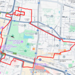
Asahikawa Circle Walk 38km
A circle with a radius of 3.14 km drawn in the central city of Hokkaido✨Located in the center of Hokkaido, Asahikawa…
-
Miyakojima Circle Walk 27km
A circle with a radius of 3.14 km on an island in everlasting summer✨This course is a circle with a radius of 3.14km…
-
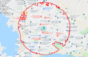
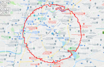
Naha Circle Walk 39km
A circle with a radius of 3.14 km drawn around the center of Okinawa Island✨This is a course that draws a perfect ci…
-
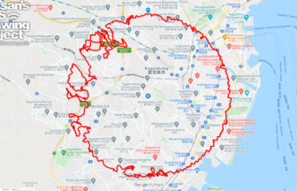
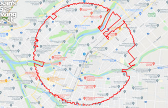
Kagoshima Circle Walk 53km
A circle with a radius of 3.14 km in the "Naples of the East"✨Kagoshima City is a core city located in a corner of t…
-
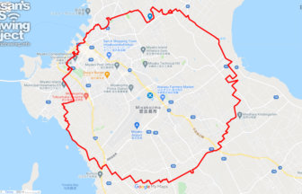
Miyazaki Circle Walk 31km
A circle with a radius of 3.14 km in one of Japan's leading tourist cities✨The course forms an equilateral circle wi…
-
Oita Circle Walk 48km
A circle with a radius of 3.14 km drawn in the Bungo Province✨It is a city where civilization started so ancient tha…
-
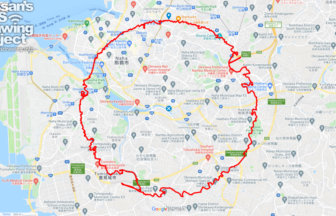
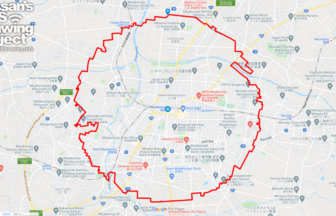
Kumamoto Circle Walk 35km
A circle with a radius of 3.14km drawn under Kumamoto Castle✨Kumamoto City is one of the most important ordinance-de…
-
Miyakonojo Circle Walk 34km
A circle with a radius of 3.14 km drawn at the birthplace of the Shimazu family✨Exactly 1,000 years ago, in the late…
-
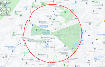
Funabashi Circle Walk 2.6km
A circle drawn on the site of a wireless telegraph station✨The Funabashi Transmitting Station of the Naval Wireless …