Ibaraki
- Sort condition
- Newest first
- Oldest first
- Large number of views
-
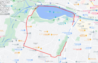
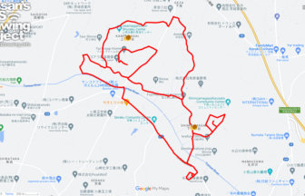
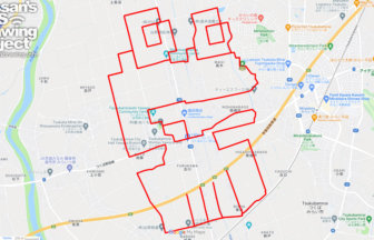
“C” in Mito, Ibaraki pref.…
International cooperation by GPS art of “C” onto Mito! This course is to draw GPS art in the center of Mito City.
-
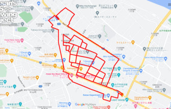
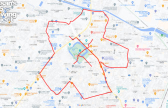
Natto in Mito, Ibaraki pref. 9km
This course allows you to draw "straw natto (Nattō wrapped in rice straw)" GPS art in the center of Mito City, the ci…
-
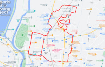
Ganbaro Noto in Koga 17km
Run and walk to support Noto Peninsula! A GPS art course where you can draw a Noto Peninsula support logo in Koga.
-
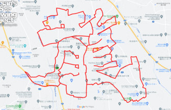
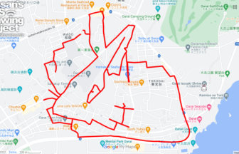
“Dragon” in Daishoin Templ…
This GPS art course allows visitors to draw the Chinese character for the Chinese zodiac animal "dragon (龍)" around …
-
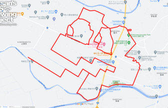
Snail in Amagai, Ibaraki, Ibaraki pref…
Snail GPS art to be drawn in the rainy season🐌✨Don't miss out on the rainy season! This is a GPS art course where you…
-
Cherry Blossom in Kijō Park, Tsuchiura…
Spring's First One Step Ahead! GPS art of cherry blossoms✨This course draws cherry blossoms GPS art in Kijo Park, on…
-
Rabbit in Oarai Isosaki Shrine, Oarai,…
Rabbit GPS art drawn at a Hatsumode spot in Ibaraki🐰✨A course of GPS art of the zodiac animal, the rabbit, drawn at a…
-
Frog in Domae Nature Park, Inashiki, I…
Drawing in Frog Park, Frog GPS Art✨This is a course of GPS art of frogs to draw in Douzen Nature Park, a nature park …
-
Frog in Kaeru Park, Tsukubamirai, Ibar…
Frog GPS art to be drawn in a park named after frogs✨This GPS art course is located in a quiet residential area and d…
-
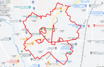
Cherry Blossom in Kamine Park, Ibaraki…
GPS art of cherry blossoms drawn on a famous landmark representing Hitachi City✨This is a GPS art course of cherry bl…


