Landmark
- Sort condition
- Newest first
- Oldest first
- Large number of views
-
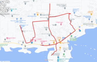
“ゆ (Hot Spring)” in Shirah…
Nojimazaki, the southernmost tip of the Boso Peninsula, you can draw "yu (ゆ)" GPS art in a hot spring resort with an…
-
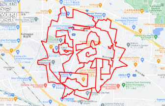
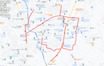
Atsube in Kumagaya, Saitama pref. 23km…
GPS art of the sun, drawn in places that often appear in the hot summer press🌞The lingering summer heat is still very…
-
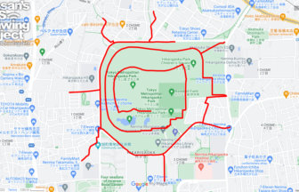
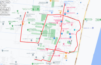
The SUN in Hikarigaoka Park, Nerima, T…
GPS art of the sun, drawn in places that often appear in the hot summer press🌞The lingering summer heat is still very…
-
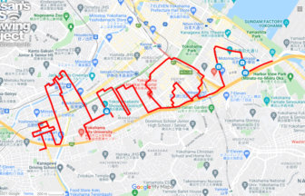
Skyline in Yokohama 12km
GPS art drawing landmarks in one of Japan's leading port cities✨This is a GPS art of cityscapes to be drawn in the po…
-
Kyoto Tower in Shimogyo Ward, Kyoto 11…
GPS art of the landmark "Kyoto Tower" drawn in one of Japan's most famous sightseeing spots✨This is a course of GPS a…
-
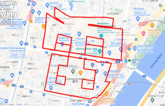
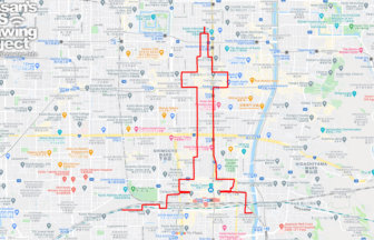
Thunder (雷) in Asakusa, Tokyo 4km
GPS art drawing on Asakusa Kaminarimon, one of Japan's most popular tourist attractions✨This GPS art course allows yo…
-
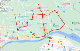
“ゆ (Hot Spring)” in Tateya…
GPS art of “YU” to be drawn in one of the most famous hot springs in Tateyama♨✨A course of “ゆ (hotspring)” GPS art d…
-
“ゆ (Hot Spring)” in Shirak…
GPS art of “YU” to be drawn in one of the most famous hot springs in Boso Peninsula♨✨A course of “ゆ (hotspring)” GPS…
-
“ゆ (Hot Spring)” in Kinuga…
GPS art of “YU” to be drawn in one of the most famous hot springs in Nikko♨✨A course of “ゆ (hotspring)” GPS art draw…
-
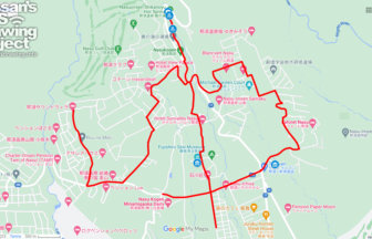
“ゆ (Hot Spring)” in Nasu T…
GPS art of “YU” to be drawn in one of the most famous hot springs in Kanto Region♨✨A course of “ゆ (hotspring)” GPS a…


