
Contents
Your moving track becomes art!
Pioneer Yassan explains about GPS art.
GPS ART is an art category in which you move around while recording your location with Global Positioning System (GPS), and draw pictures and/or messages on the tracks.
STEP1. Get your course plan.
The first step is to decide what kind of picture or message you want to draw.
Motifs such as “seasonal stories,” “animals,” and “characters” may be familiar to you.
Simple symbols such as hearts are also recommended for beginners.
| Seasonal Stories | New Year’s Day (Chinese zodiac animals, number of the year), Valentine’s Day (hearts), St. Patrick’s Day, Spring (cherry blossoms), Rainy Season (umbrellas, frogs), Summer Vacation (parasols, watermelons), Autumn (maples, ginkgo trees), Sports Event (people running), Halloween (pumpkins, bats, ghosts), Christmas (Santa, reindeer), any other anniversaries. |
| Snimals | cat, dog, rabbit, elephant, giraff, cow, etc. |
| Characters | Be careful about copyright. |
| Maps | Silhouette of your country, World Map, Islands, Prefectures, etc. |
| Messages (texts) | Birthday messages, marriage proposal messages, messages of support for your favorite member, etc. |
Plan your own course.
In most cases, you will be trying to draw with one stroke, so the drawing must be simple with connected lines.
When drawing animals or people, it is also important to know how far to draw them. Whether you draw only the face or the whole body will greatly affect the distance and the degree of reproduction. If you start with just the face, you’ll find it easier!
Tips.
How to put a picture into a map is different for each person.
For me, the key is to focus on the important points first, and then work on the details. I think the important point is the feature of the motif.
Decide on your route.
The last step is to determine the route. Decide which route is the most reasonable to draw in one stroke. It may take some time, but if you take the time to do this, it will be easier to visualize the route when you actually draw it.
Note: Length of the course
I think that the length of you first piece must be shorter. If you have ever walked while following a map in your daily life, you may not be particularly concerned, but I think it takes a surprising amount of getting used to following a path while relying on a map for the first time. However, anyone who has done it a couple of times will be fine with it.
Even children in the lower grades of elementary school were able to read the map easily.
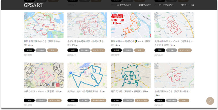
Use courses in gpsart.info
This site has over 1,000 course plans categorized by prefecture, length, and theme.
Let’s start by looking for courses in your neighborhood!
We are also accepting requests for course plans.
Please feel free to send us a request using the contact form!
Please write “Course Plan Request” in the subject line.
All course plans can be viewed in various online services. (GoogleMaps / Strava / RunGo / PDF, etc.)
At the bottom of each course page, there is a “Course Details (External Links)” button.
Click on the button and check out the course details in your favorite media.
It’ll be handy to open it on your phone or print it out on paper, in case you actually want to draw it!
Note: There are also online services that require you to get an account and log in beforehand.
Find a course!
STEP2. Try it out! Walking / Running
You can actually move around while looking at the map you got.
If you use a smart phone, it will be even more convenient as it will serve as a navigation system!
You can also print out the map on paper beforehand.
Tips on how to run/walk
Memorize the marker for the next turn, and when you turn, memorize the next one, and repeat!
The trick is to memorize a little bit of the road ahead of you, like “turn right at the first corner”. It is also helpful to mark landmarks such as stores, traffic lights, bridges, and other structures.
Depending on the type of service, there are also smartphone apps that will give you voice directions at the corner of a turn; although not 100% reliable, it is useful to prevent carelessness.
Record by GPS
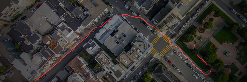
When you are on the move, use a GPS device to record your tracks.
Smartphone apps and running watches (GPS watches) are useful.
A common mistake is to pause in the middle of a run for a bathroom break or shopping stop and forget to restart. I have heard of this case quite a lot, so please be extra careful!
Caution
- Don’t look at your phone while walking!
- Follow the local traffic rules!
- Please note that we are not responsible for any accidents.
Useful Information
STEP3. GPS ART is done! See the results.
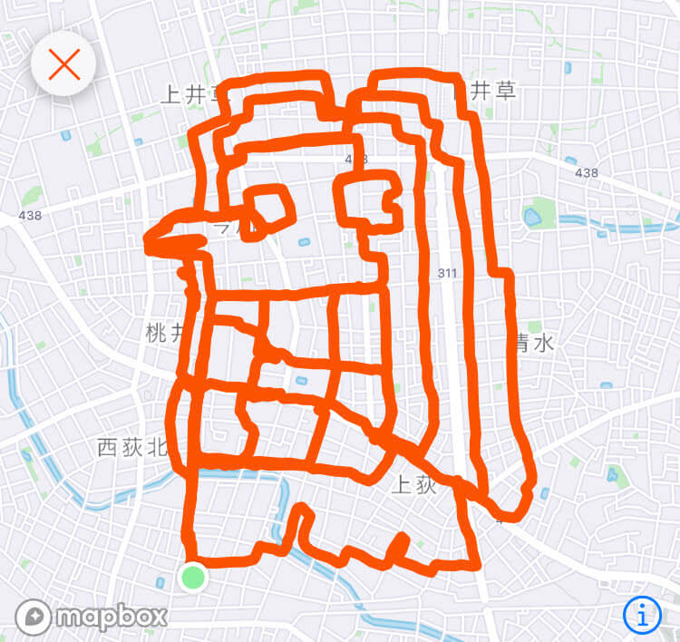
The tracks of movement are a picture.
If you draw it with a running app, it will draw the track on the map in real time.
You can get the image from the app after your run, so it’s easy to keep the trajectory as a memory.
Share the results of your drawing on social media!
Which hashtag would be best to share on social networking sites?
This art of drawing with GPS is called by different people in different ways. It’s interesting to note that there is no fixed name for it in every country.
Here is a list of typical names.
#GPSart
#GPSdessin
#GPSdrawing
#GPSkunst
#runningart
#STEPNART
#STRAVAART
#trackingart
#walkingart
There are many different words.
The Guinness World Records uses the name GPS Drawing, so the official name may be this one, but if you want to post it on social media, “GPSart” or “STRAVAART” may be more familiar.
Just give it a try!
Let’s find out which course is your favorite!


