Contents
At first glance, it may seem that all you have to do is “draw with the tracks you move,” but in fact there are a wide variety of techniques.
As a veteran who has been drawing with a variety of techniques since the dawn of GPS art, I will explain it from a gentle and somewhat technical point of view.
Types of Drawing Techniques
Although various techniques have been developed, they can be classified into the following categories.
- Single Line / Multi-Line
- Freehand / Roads Only / Connect the Dots
- Line Drawing / Painting
- Others (Group Work / Video / 3D / Live Drawing)
1. Single Line / Multi-Line
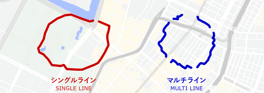
The difference is whether the drawn line is a single line or multiple lines.
Single Line (One Stroke)
A technique of drawing with a single line. In short, it is “one stroke.
Most of the GPS art shared on social networking sites, including “running art”, “GPS run”, and #STRAVAART, which are popular these days, belong to this category.
As a background, there is a big reason why smartphone applications for displaying trajectories only support a single line.
Since it is drawn with a single line, it creates restrictions on the activity, such as range and time.
Multi Line (Multi Stroke)
This is a technique of drawing with multiple lines.
Since it is possible to draw separate times and places, it is possible to create larger scale works compared to single lines.
In order to display multiple lines on the same screen, you need to use a map application such as Google Maps. This is a somewhat difficult technique because it requires specialized knowledge.
2. Freehand / Roads Only / Connect the Dots
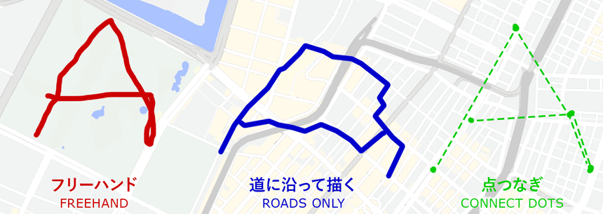
The difference is how we record the trajectory of our movement.
It is a concept born from geographical conditions and constraints.
Freehand
It is a technique of drawing in a field where one can move freely, such as a park or an open space.
In other countries, works have also been published in which the artist draws in deserts, lakes, and on the surface of the sea.
The trick is to keep track of your position in real time so that you can easily correct your course.
Roads Only
Draw while moving along the road.
Most of the published works belong to this category.
There are constraints of the road and traffic rules, but the lines that are accidentally created from these constraints create a unique taste in the work.
Connect the Dots
It is a technique that allows you to draw freely without being restricted by the constraints of roads and rivers.
By repeatedly pausing and resuming the drawing with the GPS device, the artist can connect the lines like connecting dots.
When drawing a single line, some artists use this technique when their way is blocked by a river or other obstacles.
3. Line Drawing / Painting
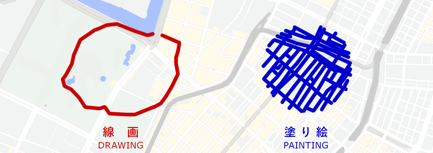
The difference is whether to show the drawn image as a line or as a colored surface.
Line Drawing
The moving trajectory is considered as a “line” and is used to draw the outline of letters and pictures.
Most of the published works belong to this category.
Painting
This is a technique in which the artist moves back and forth within the area to be shown with colored surfaces, concentrating the drawn lines and expressing them as a “surface.
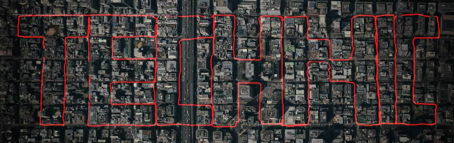
This technique is often used in urban areas with dense streets.
4. Others
Because of the special format of the presentation, most of the type of GPS arts are presented for the purpose of events and performances.
Group Work
Most of the common GPS art is drawn by one person, but there are also works drawn by multiple people. The main specifications are as follows.
Draw all at once at the same time
The participants draw lines in various places within a certain time frame.
By combining the lines drawn by each participant, a single image is created.
Draw in relay style
A GPS device is used as a baton to connect multiple people to draw.
This makes it possible to create long-distance works that would be difficult for a single person to accomplish physically.
Video
This is an expression in which the trajectory you have drawn is animated on a map.
Recently, with the introduction of the dedicated application like Relive, it has become even easier to create.
3D Drawing
Generally, two-dimensional works drawn on the ground or water surface are the mainstream, but there are also 3D drawings (three-dimensional works) drawn in the air with additional height information.
Live drawing
The production process (moving images) is displayed and presented in real time.
This is ideal for conveying a sense of live production.
A special system or application is required for the presentation.
In addition, it is safer to apply delayed display because it poses a security risk since your current location is known.
Getting Trends
I’m happy to see that the number of works is voluminous enough to be systematized 😀✨.
At the time of this writing (November 2020), “GPS runs” and “drawing runs” using running apps are on the rise.
From the perspective of running culture, there are some unique policies and restrictions, such as “no turning back,” “minimal double paths,” and “fewer turns are better. It would be interesting to see more works on …… so that we can compare and classify them.
Just give it a try!
“I have an idea for a GPS drawing, but I don’t know how to do it.” “Is there a technique that works best?” or, “I’m not sure what I should pay attention to. ……”
Experienced professionals who have created more GPS art than anyone else are available for consultation✨
Please contact us using this contact form.


