Contents
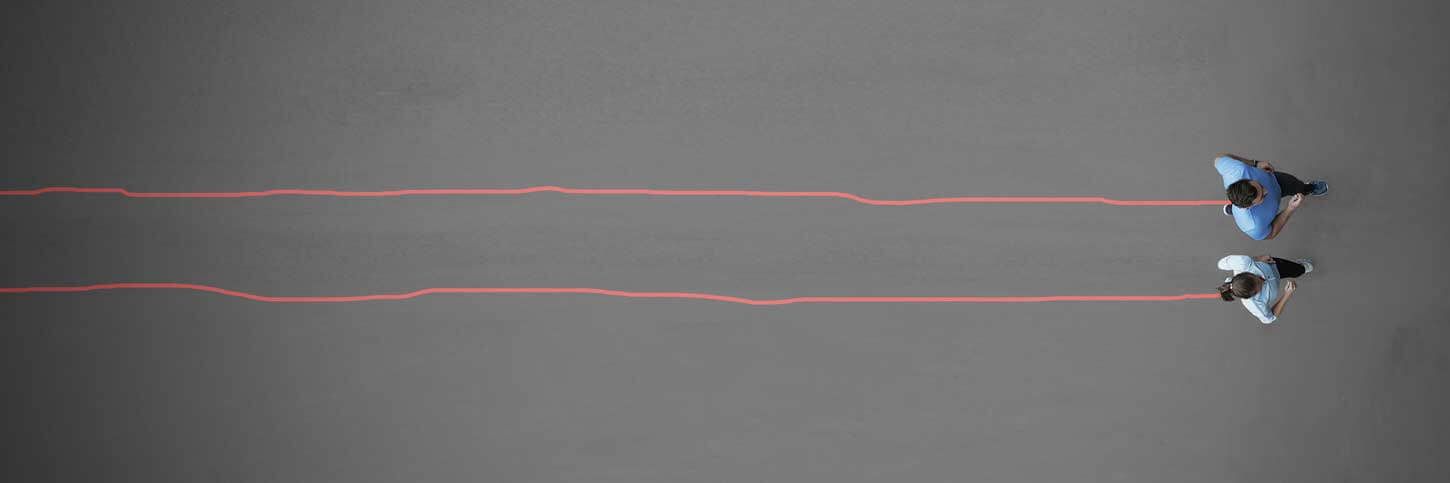
At first glance, it may seem that all you have to do is “draw on a moving track,” but in fact there are many different techniques.
As a veteran who has been drawing with various methods since the dawn of GPS art, I will explain it in a gentle manner.
Type of Activity (transportation)
The major categories are as follows.
There are many theories, but my rule of thumb is that these are the simplest categories.
They all have their advantages and disadvantages, so I tend to use them differently.
- Running / Walking
- Vehicle
- Public transportation
- Others
1. Running / Walking
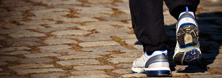
They do not rely on vehicles, but move under their own power to draw GPS art.
This is the method of drawing instead of daily exercise.
While it is the most flexible, the larger the scale, the more physical strength and time are required.
Strong point
- Easy to set up No preparation required.
- Flexible lines Can be adjusted to a certain degree of road conditions.
Weak Point
- Short length of the lines Limited movement distance.
- Depend on your physic Physical strength required.
Major Activity
- Running
- Walking
- Swimming
Running
Nowadays, GPS runs and STRAVAART are trending among citizen runners.
This is partly because STRAVA is pushing #STRAVAART, but also because many runners who have been aiming to participate in competitions have started to do so as a new way to maintain their running motivation due to the trend of the cancellation of corona disasters.
Walking
An exercise that is relatively fitness independent and easy to start.
In many cases, people who love geography have started GPS walks as a form of development of the logging/orienteering culture, including city walking and sightseeing.
Swimming
It is drawn by swimming in a lake or ocean (open water).
This is a genre that can only be executed by those who are confident swimmers, although they are a very small minority.
2. Vehicle
It is subdivided according to the presence or absence of a prime mover and the field in which it moves.
In this section, let’s focus on vehicles that can move freely at will (not public transportation).
While it is possible to create works on a larger scale than if you were to move around on your own, there are many restrictions on transportation, such as driving licenses and traffic rules.
Strong point
- Large scaled Enable to do on a scale and in places that you can’t do a walk or run.
- Easy to move No need to physical just like walking/running.
Weak Point
- Location constraints Follow the traffic rules!
Major Activity
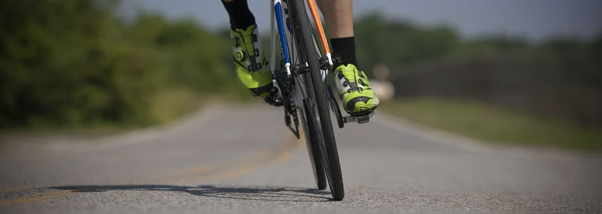
- Bicycles / Road Bikes
- Motorcycles / Automobiles
- Canoeing / boating / water skiing
- Hang glider
Bicycles / Road Bikes
A method of GPS drawing on land by moving around in a vehicle without an attached motor.
Many of the works drawn in the vehicle genre are drawn on road bikes.
This genre has many fans, especially in Europe and North America.
The fact that cyclists were using cycle computers to manage their activities, STRAVA (promoting STRAVAART) was gaining users, especially cyclists, and the PHILIPS campaign (GPS art drawn on road bikes) also had an impact.
Motorcycles / Automobiles
A method of GPS drawing by moving over land with a motorized vehicle.
With a car, it is easy to create works of a scale of several days because you can stay in the car, but there are many restrictions due to traffic rules and road conditions.
Canoeing / boating / water skiing
This is a method of drawing using a boat moving on the water.
It is a genre that has a certain number of fans overseas.
In Japan, it is rarely seen because there are few places to practice where you can move freely.
Also, depending on the country and type of ship, a ship’s license is required.
Hang glider
A method of drawing using an aircraft used for flight.
Since it moves in the air, there are no restrictions by road.
However, please be sure to create within the limits of safety and aviation laws.
3. Public Transportation
It is difficult to choose a best course of action because the routes are very restricted.
In reality, you will have to use multiple means of transportation.
The departure/arrival time is fixed, so you need to plan your trip accordingly.
It is recommended to enjoy it as one of the contents of your trip because you can enjoy an extraordinary feeling!
Strong point
- Easy to move Do not need to drive yourself, so you can relax on the move.
- Enjoyong Non-daily feeling You can use routes that you don’t normally use.
Weak Point
- Location constraints You have to move on very limited route.
- Budget Transportation costs are huge!
Major Activity
- Buses
- Railroads / Monorails / Trams
- Ferry
- Airplane
Buses
The key to urban transportation.
There is not much public information on bus routes, so it is essential to gather information.
Although maps of bus routes exist, there are few cases where the exact routes have been made public. Careful travel planning is necessary.
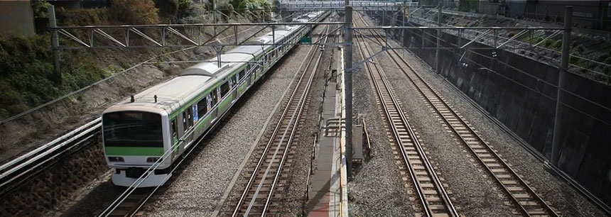
Railroads / Monorails / Trams
There are only a few train lines, and the routes you can draw are very limited.
Especially in rural areas, the number of trains is limited, so it is important to check the timetable.
However, there are some routes that can only be taken on that track, so if you can make good use of them, you can create highly original works.
Ferry
It is a useful means of transportation between land areas.
When I am working on a project that will take me across Japan, I will be very grateful for the help.
Please make sure you know the timetable and whether or not your vehicle can be loaded before scheduling.
Also, many long-distance ferries require advance reservations to board.
Airplane
It can be used to create very large scale works of art.
There are occasional exceptions where airlines and small planes use flight recorders to draw, but the general public makes use of regular flight routes to draw.
When I did a round-the-world project, I took 31 flights. Because of the cross-country travel, in addition to the schedule, it required careful planning and preparation, such as visas and vaccines. I would not recommend this unless you have traveled abroad before…😅
4. Others
Since the methods are rare, they tend to attract attention to the implementation itself.
Although they are in a very small minority, there are actual works drawn with these techniques.
Major Activity
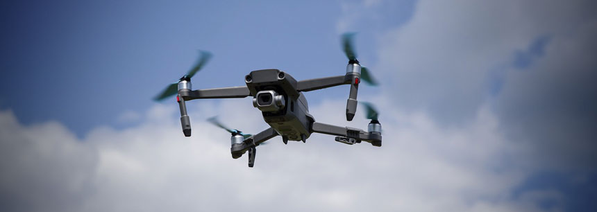
- Drone Features the ability to draw 3D artwork that also uses altitude.
- Hitchhiking A Japanese TV show featured a project where a comedian drew all over Hokkaido island.
- Delivery route A video of global GPS art using GPS embedded in luggage was once a hot topic! (but this drawing was the fake…)
Just give it a try!
“This is my first time creating with GPS.” “It’s a large scale work, so I don’t know what to focus on”
If you have such problems, please feel free to contact us✨.
I can provide you with the knowledge gained from successfully completing a wide variety of GPS art projects.
Please contact us using this contact form.


