Symbol
- Sort condition
- Newest first
- Oldest first
- Large number of views
-
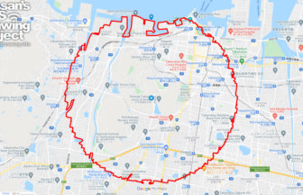
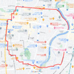
Takamatsu Circle Walk 33km
A circle with a radius of 3.14 km drawn at the gateway to Shikoku✨The course is a 3.14 km radius circle around Takama…
-
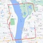
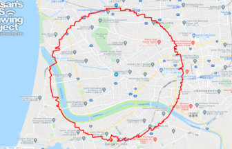
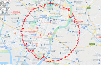
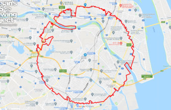
Okayama Circle Walk 35km
A circle with a radius of 3.14 km drawn on Okayama Castle✨Mt. So-zan, which was the center of the region in ancient t…
-
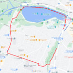
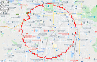
Izumo Circle Walk 26km
A circle with a radius of 3.14 km drawn on the plain in front of Izumo Taisha Shrine✨The course is a 3.14km radius ci…
-
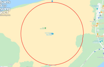
Tottori Circle Walk 3.14km
A 3.14km-long circle drawn on the Tottori Sand Dunes✨Isn't it a foul to draw freehand on an empty space? But here is…
-
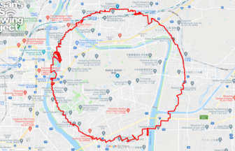
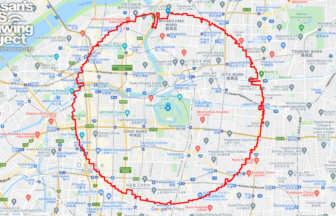
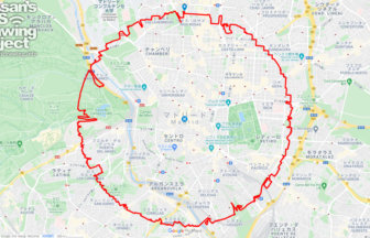
Nara Circle Walk 32km
A circle with a radius of 3.14 km drawn in Heijo-kyo✨Heijo-kyo, the center of the Nara period, a part of Japanese his…
-
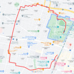
Himeji Circle Walk 33km
A circle with a radius of 3.14 km drawn on the World Heritage Site✨Himeji Castle, also known as Shirasagi-jo (White E…
-
Osaksa Circle Walk 33km
A circle with a radius of 3.14 km drawn around the Osaka Castle tower✨Osaka Castle, built in the Azuchi-Momoyama peri…
-
Madrid Circle Walk 38km
A circular course with a radius of 3.14 km drawn in the center of Spain✨Kilómetro Cero is a road marker that serves a…
-
Yokkaichi Circle Walk 37km
A circle with a radius of 3.14 km drawn in a huge industrial area✨Yokkaichi City is an industrial city representing t…
-
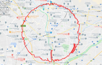
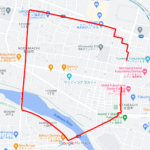
Kofu Circle Walk 36km
A circle with a radius of 3.14 km drawn in the lap of Takeda Shingen✨The Kofu Basin is a fan-shaped area located in t…