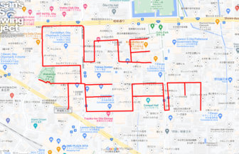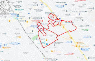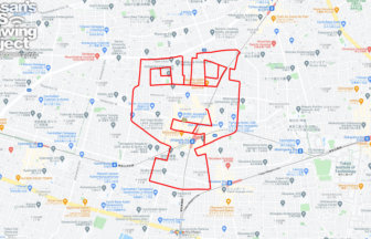
Tracing “Higashiyamato” — GPS Art by Lake Tama✨
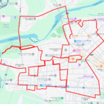
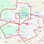
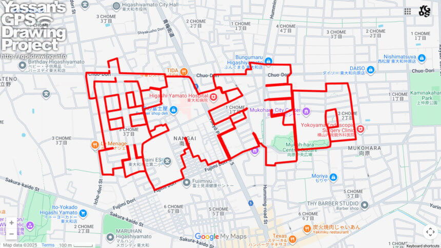
This 12km GPS art course invites you to explore Higashiyamato City, located in the northern part of Tokyo’s Tama region, while drawing the city’s name, “東大和 (Higashiyamato),” across its streets. Starting from the residential neighborhoods north of Higashiyamato Station, the route leads participants through the Higashiyamato City Hall, the cultural hub “Humming Hall,” and community landmarks such as the Mukohara Civic Center and Mukohara Central Plaza, weaving together the city’s name in large, bold strokes.
The name “Higashiyamato” dates back to the late 19th century. When the former Yamato Village transitioned into city status, the prefix “Higashi” (East) was added to distinguish it from Nara Prefecture’s Yamato. Geographically, the city rests on the Musashino Plateau. Once a rural landscape of satoyama woodlands and farmland, it transformed dramatically with the construction of Tama Lake and the expansion of railway networks. Today, Higashiyamato thrives as a residential city where urban life and rich natural environments coexist in harmony.
The city is also home to archaeological sites dating back to the Jomon period, showcasing its deep-rooted history of human settlement. Seasonal beauty unfolds around Tama Lake, offering lush greenery in spring, cool breezes in summer, vibrant foliage in autumn, and serene views in winter. Alongside its natural scenery, Higashiyamato boasts cultural venues and community facilities that foster a welcoming spirit for both residents and visitors.
By combining history, nature, and modern city life, this GPS art course provides a unique way to experience the charms of Higashiyamato. Lace up your shoes and set out on a special run or walk that lets you draw the city’s name while discovering its cultural depth and natural beauty.
DETAIL (EXTERNAL LINK)

A PIONEER IN GPS ART.
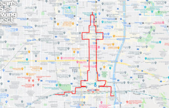
1st work was authorized by Guinness World Records as “the Largest GPS Drawing”.
He is the only Japanese person to be featured in a Google documentary as an innovator. He is fascinated by the idea of drawing with GPS and has published more than 2,500 works.