Kanto Region
- Sort condition
- Newest first
- Oldest first
- Large number of views
-
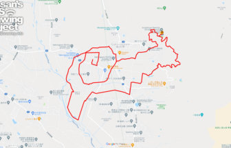
Frog in around Sōken-ji, Ome city, Tok…
A temple with six frogs to welcome you🐸🐸🐸🐸🐸🐸✨Six frog statues greet you in front of the main temple.rejuvenateprosper…
-
Snail in around Rakuhōji Temple in Sak…
A course of snails drawn on a hydrangea temple in Ibaraki🐌✨Named after a prayer for rain during a drought, the precin…
-
Snail in around Nogoji Temple in Kumag…
A course of snail drawn on a hydrangea temple in Kumagaya🐌✨The temple has a long history and was founded by Gyoki in …
-
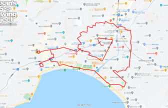
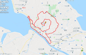
Snail in around Hasedera Temple in Kam…
GPS art of snail to enjoy the whole Kamakura area🐌✨Hasedera Temple, one of the most famous tourist attractions in Kam…
-
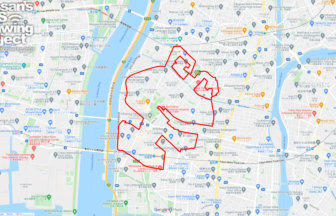
Frog in around Horyuji Temple, Edogawa…
A course on drawing in Tokyo's representative frog temple🐸✨There is a temple in Edogawa Ward, Tokyo, where a "memoria…
-
Frog in Jiyugaoka, Tokyo 8km
A course on drawing in Tokyo's leading frog goods specialty store🐸✨FROGS🐸, a frog goods specialty store located in th…
-
Snail in around Nihonmatsuji in Itako …
A course in GPS art of snails painted on a hydrangea temple in Ibaraki🐌✨A temple with 10,000 hydrangea plants and 100…
-
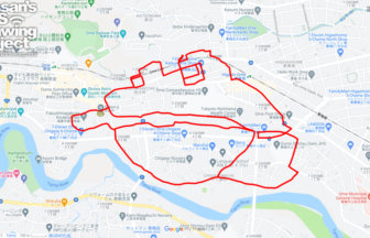
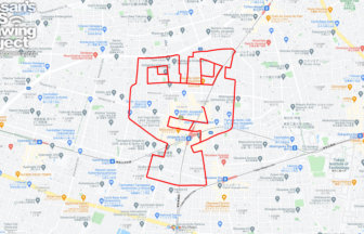
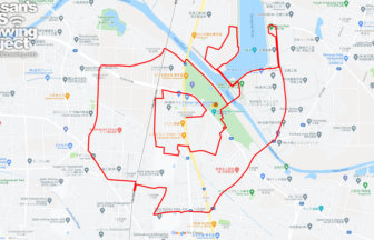
Frog in Shinjuku, Tokyo 10km
A course of GPS art of frogs drawn on shrines with a high target rate🐸✨Kaichū Inari Shrine, a shrine with a reputatio…
-
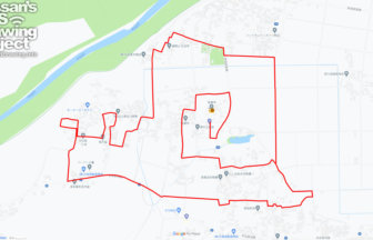
Snail in around Kenei Gongendo Park in…
16,000 hydrangea plants welcome you🐌✨Gongendo Park is famous for its cherry blossoms, but the citizens of Gongendo Pa…
-
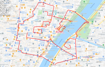
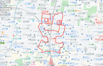
Frog in Asakusa, Tokyo 7km
Recreate "Kerokichi" on Nakamise street with GPSP art 🐌✨.This course depicts Kerokichi, the mascot of Koike Shoten, a…


