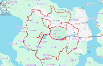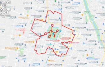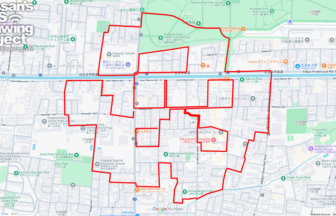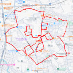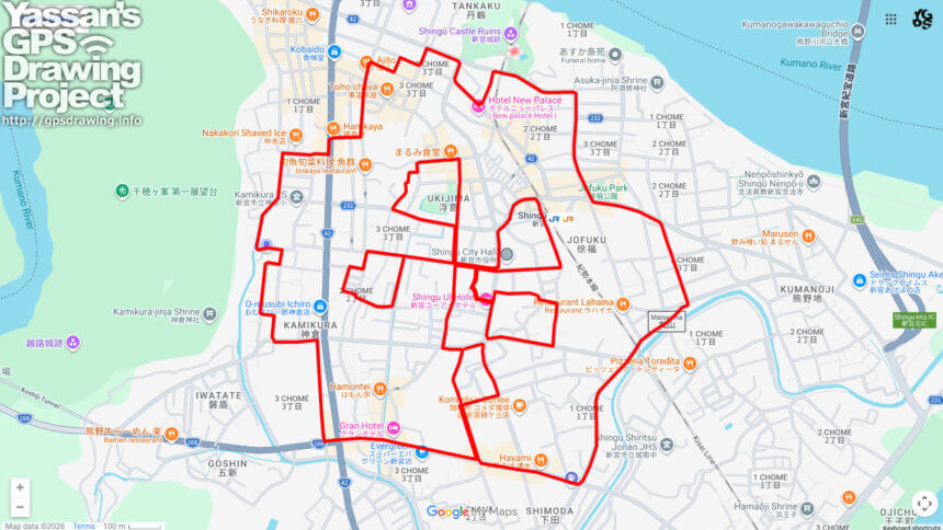
🌸 Historic Ruins and Mystic Forests: A 10km Sakura Loop in Shingu 🌸
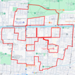
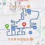
Shingu City in Wakayama Prefecture serves as the majestic gateway to the Kumano Kodo World Heritage sites. In this city where spiritual energy meets natural splendor, you can enjoy a 10km GPS art course that traces a grand cherry blossom (Sakura) across the local landscape. This circuit centers on Tankakujo Park, the site of the former Shingu Castle overlooking the mouth of the Kumano River.
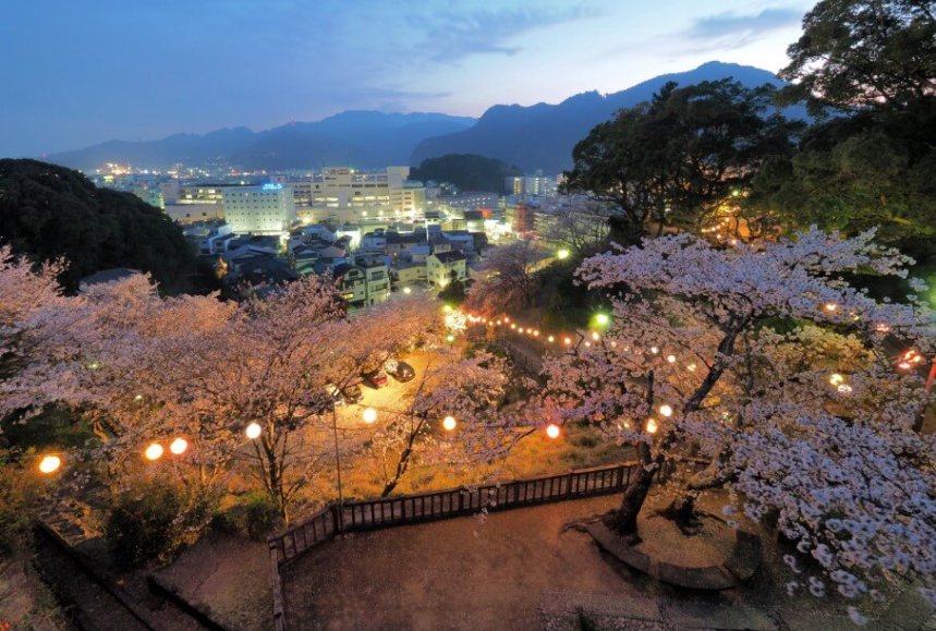
The park’s name, “Tankaku,” originates from Princess Tankaku, who resided here long before the Mizuno clan fortified the hill during the Edo period. Today, the park is famous for its imposing stone walls that provide a dramatic backdrop for hundreds of Somei-Yoshino cherry trees. From the summit, participants are rewarded with a panoramic view of the emerald-green Kumano River meeting the vast Pacific Ocean—a vista that has remained a strategic marvel for centuries.
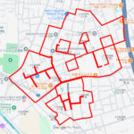
The route also encompasses the area around Shingu Station and the mysterious Ukijima-no-Mori. This “Floating Island Forest” is a rare ecological site where a thick raft of vegetation floats on a pond, designated as a National Natural Monument. Walking through this area feels like stepping back into a primeval era.
This 10km course combines the flat streets of the downtown area with the gentle elevation of the castle ruins. Since there is no fixed start or end point, you can begin your journey anywhere within the loop. As you follow the path to complete the delicate petals of the digital Sakura, you connect the ancient heritage of Shingu with the fleeting beauty of its spring. It is a perfect way to experience the cultural pulse of Kumano through your own footsteps.
DETAIL (EXTERNAL LINK)

A PIONEER IN GPS ART.
1st work was authorized by Guinness World Records as “the Largest GPS Drawing”.
He is the only Japanese person to be featured in a Google documentary as an innovator. He is fascinated by the idea of drawing with GPS and has published more than 2,500 works.