Official

Sort condition
Newest first
Oldest first
Large number of views
  1. 越谷サークルウォーク(埼玉県越谷市)のGPSアート
    • SaitamaKanto Region
    • 31km - 50km
    • Circle WalkSymbolOfficialLetter/Symbol/Map

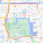
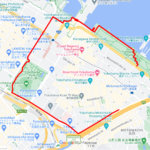
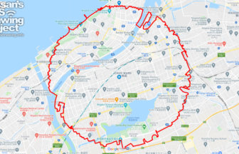
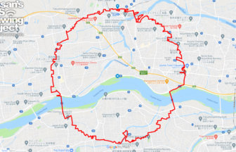
    Koshigaya Circle Walk 37km

    A circle with a radius of 3.14 km drawn around the Awa Odori statue✨Koshigaya City is one of the largest bedroom comm…

  2. 佐賀サークルウォーク(佐賀県佐賀市)のGPSアート
    • SagaKyushu & Okinawa Islands
    • 31km - 50km
    • SymbolCircle WalkOfficialLetter/Symbol/Map

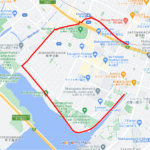
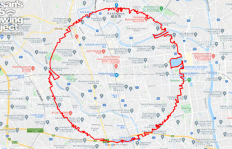
    Saga Circle Walk 39km

    A circle with a radius of 3.14 km drawn in the city of water✨The Saga Plain is one of the most important granary area…

  3. Sendai Circle Walk
    • MiyagiTohoku Region
    • 31km - 50km
    • Circle WalkSymbolOfficialLetter/Symbol/Map

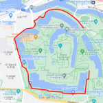
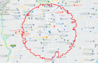
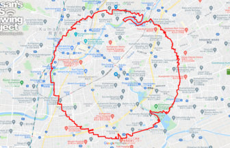
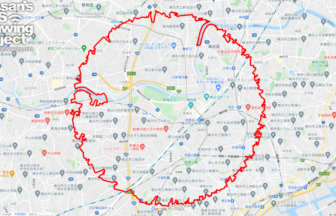
    Sendai Circle Walk 41km

    A circle with a radius of 3.14 km drawn in the castle town of Sendai✨This course is a circle drawn in the heart of To…

  4. 新潟サークルウォーク(新潟県新潟市)
    • NigataChubu Region
    • 31km - 50km
    • Circle WalkSymbolOfficialLetter/Symbol/Map

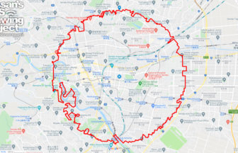
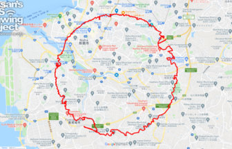
    Nigata Circle Walk 35km

    A circle with a radius of 3.14 km drawn in the urban area of Echigo✨Niigata City is the only ordinance-designated cit…

  5. 熊本サークルウォーク(熊本県熊本市)のGPSアート
    • KumamotoKyushu & Okinawa Islands
    • 31km - 50km
    • SymbolCircle WalkOfficialLetter/Symbol/Map

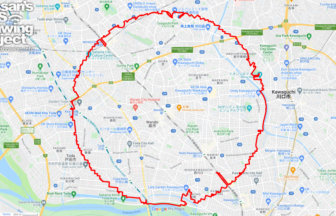
    Kumamoto Circle Walk 35km

    A circle with a radius of 3.14km drawn under Kumamoto Castle✨Kumamoto City is one of the most important ordinance-des…

  6. 那覇サークルウォーク(沖縄県那覇市)のGPSアート
    • OkinawaKyushu & Okinawa Islands
    • 31km - 50km
    • SymbolCircle WalkOfficialLetter/Symbol/Map

    Naha Circle Walk 39km

    A circle with a radius of 3.14 km drawn around the center of Okinawa Island✨This is a course that draws a perfect cir…

  7. 鳥取サークルウォーク(鳥取県鳥取市)のGPSアート
    • TottoriChugoku Region
    • - 10km
    • Circle WalkSymbolOfficialLetter/Symbol/Map

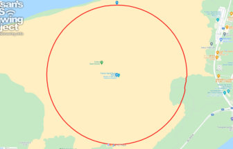
    Tottori Circle Walk 3.14km

    A 3.14km-long circle drawn on the Tottori Sand Dunes✨Isn't it a foul to draw freehand on an empty space? But here is…

  8. 徳島サークルウォーク(徳島県徳島市)のGPSアート
    • TokushimaShikoku Island
    • 31km - 50km
    • Circle WalkSymbolOfficialLetter/Symbol/Map

    Tokushima Circle Walk 37km

    A circle of radius 3.14 km drawn in the Yoshino River basin✨This circle walk is drawn in the basin of the Yoshino Riv…

  9. Yokohama Circle Walk
    • KanagawaKanto Region
    • 31km - 50km
    • Circle WalkSymbolOfficialLetter/Symbol/Map

    Yokohama Circle Walk 46km

    Circle drawn around the center circle of Nissan Stadium✨Nissan Stadium, the center of sports culture in Yokohama and …

  10. 蕨サークルウォーク(埼玉県蕨市)蕨サークルウォーク(埼玉県蕨市)のGPSアート
    • SaitamaKanto Region
    • 31km - 50km
    • SymbolCircle WalkOfficialLetter/Symbol/Map

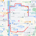
    Warabi Circle Walk 33km

    Circle walk GPS Drawing with a radius of 3.14 km drawn around Warabi Station✨This is an additional course proposal fo…

  1. C(和歌山県和歌山市)のGPSアート

    “C” in Wakayama City 3km

  2. C(兵庫県西宮市)のGPSアート

    “C” in Nishinomiya, Hyogo pref. 5km

  3. C(大阪府大阪市)のGPSアート

    “C” in Osaka City 3km

  4. C(京都市左京区)のGPSアート

    “C” in Kyoto City 4km

  5. C(神奈川県横浜市)のGPSアート

    “C” in Yokohama, Kanagawa pref. 3km

  1. Cherry Blossom in Osaka Castle 9km

  2. TokyoCircleWalk

    Tokyo Circle Walk 32km

  3. Douglas MacArthur in around Yokota Base 33km

  4. 東京スカイツリーに描くこいのぼりのGPSアート

    Carp Streamer in around Tokyo Skytree 4km

  5. Cherry Blossom in around Nago Castle Park 16km

ARCHIVES