Support Noto Peninsula! Drawing GPS Art Ties All Over Japan👍✨
Run and walk to support Noto Peninsula! A GPS art course where you can draw a Noto Peninsula support logo in Kumamoto.
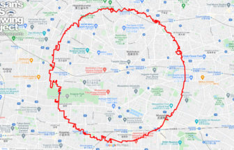
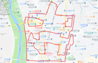
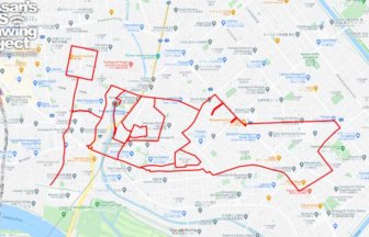
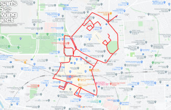
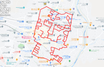
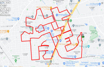
Ishikawa Prefecture is known as the “Thumb Prefecture” because the Noto Peninsula, stretching from Honshu to the Sea of Japan, looks like a thumb sticking out. We designed a logo that crosses the Noto Peninsula with the pose of a hand with a thumb up. We will present a course where this logo can be drawn in various places in Japan.
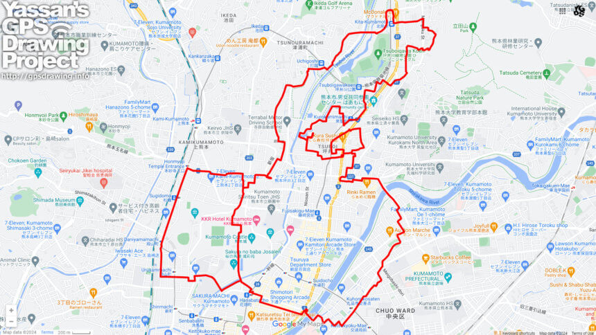
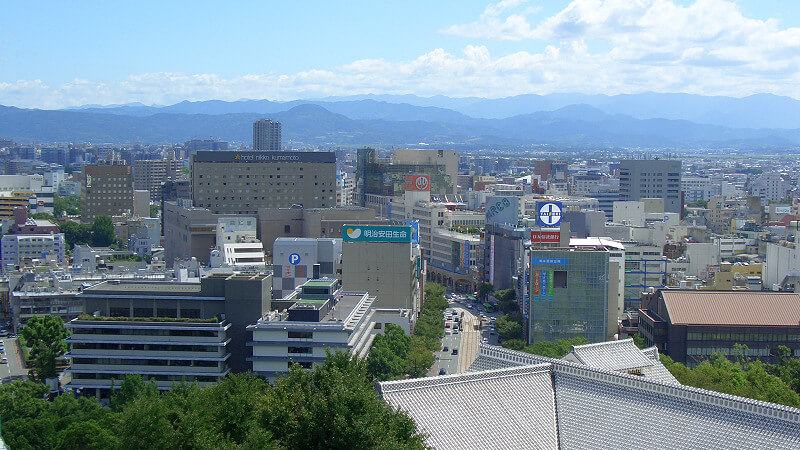
This course is a GPS art in the middle of Kumamoto City. It circles around Kumamoto Castle. It is perfect for sightseeing in Kumamoto City, where you can experience a wide variety of faces as you tour a wide area from the city center to Tsuboigawa Ryokuchi Park. We hope you will try it when you visit Kumamoto City!
DETAIL (EXTERNAL LINK)

A PIONEER IN GPS ART.
1st work was authorized by Guinness World Records as “the Largest GPS Drawing”.
He is the only Japanese person to be featured in a Google documentary as an innovator. He is fascinated by the idea of drawing with GPS and has published more than 1,500 courses.