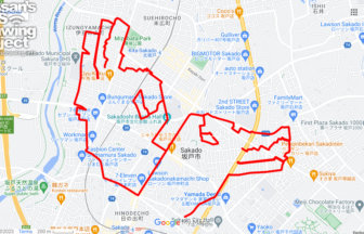
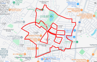
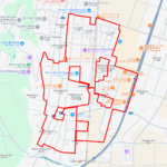
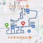
GPS art of the place name “Suginami” drawn in Suginami Ward✨
This is a series of GPS art courses that draw the place name “Suginami” in Suginami Ward, Tokyo.
Suginami Ward was created by the merger of Suginami, Wadabori, Iogi, and Takaido Towns when they were incorporated into Tokyo City in 1932. The ward’s name comes from the rows of cedar trees planted along the Ome Kaido Road by the feudal lords in the early Edo period (1603-1868). Although the rows of cedar trees have disappeared, the name of the district recalls those days.
This course can be drawn around the residential area between Ogikubo and Nishi Ogikubo stations. It may be a bit expensive to live in this popular area, but you will enjoy the atmosphere. Please try it as a new sightseeing tour of Tokyo!
TOURISTS SPOT
REFFERENCE

Source: Wikimedia Commons
DETAIL (EXTERNAL LINK)

A PIONEER IN GPS ART.
1st work was authorized by Guinness World Records as “the Largest GPS Drawing”.
He is the only Japanese person to be featured in a Google documentary as an innovator. He is fascinated by the idea of drawing with GPS and has published more than 2,500 works.