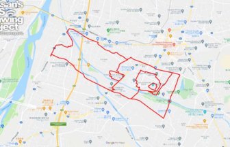
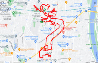
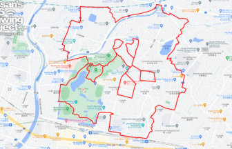
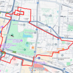
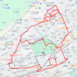
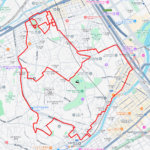
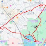
GPS art of the place name “Koto” drawn in Koto Ward✨
This is a series of GPS art courses that draw the place name “Koto” in Koto Ward, Tokyo.
Koto-ward was created in 1947 through the merger of Fukagawa-ward and Joto-ward. The name “Koto (江東)” includes the meaning of “Ko (江)” for Fukagawa (深川) and “To (東)” for Joto (城東). However, the name “Koto” has been in use since the Edo period (1603-1867), when it was used to refer to the eastern part of the Sumida River, including the Honjo and Fukagawa districts.
The course is centered on the living areas such as canals, huge apartment complexes, and residential areas. This is a new type of sightseeing tour that will allow you to learn about the people who live along the waterfront. We hope you will give it a try!

Source: Wikimedia Commons
DETAIL (EXTERNAL LINK)

A PIONEER IN GPS ART.
1st work was authorized by Guinness World Records as “the Largest GPS Drawing”.
He is the only Japanese person to be featured in a Google documentary as an innovator. He is fascinated by the idea of drawing with GPS and has published more than 2,500 works.