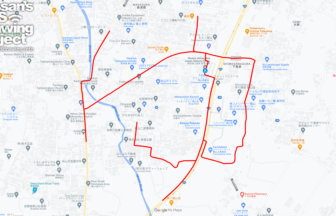
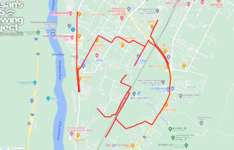
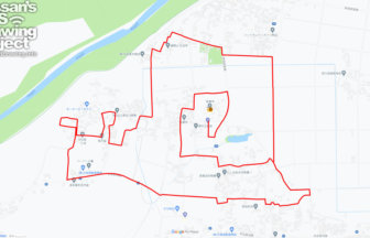
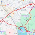
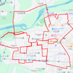
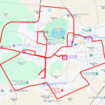
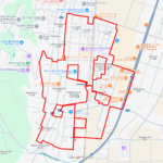
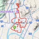
GPS art of the place name “Bunkyo” drawn in Bunkyo Ward✨
This is a series of GPS art courses that draw the place name “Bunkyo” in Bunkyo Ward, Tokyo.
Bunkyo-ward was created in 1947 through the merger of Koishikawa-ward and Hongo-ward. At the time of the merger, the Tokyo Shimbun publicly solicited ideas for the name of Bunkyo-ward, but the name “Bunkyo” was chosen instead. The University of Tokyo is also located in the area, and the fact that the name matched the image of the ward as “the home of learning” was a deciding factor in its selection.
This course allows visitors to enjoy the residential areas of the Bunkyo area. The course is also harder than the actual distance, as the place has many ups and downs. We are glad that there are people who still want to take on the challenge!

Source: Wikimedia Commons
DETAIL (EXTERNAL LINK)

A PIONEER IN GPS ART.
1st work was authorized by Guinness World Records as “the Largest GPS Drawing”.
He is the only Japanese person to be featured in a Google documentary as an innovator. He is fascinated by the idea of drawing with GPS and has published more than 2,500 works.