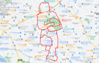
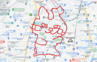
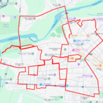
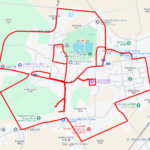
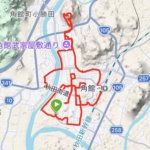
GPS art of the place name “Kita” drawn in Kita Ward✨
This is a series of GPS art courses that draw the place name “Kita” in Kita Ward, Tokyo.
Kita-ku was founded in March 1947 through the merger of Oji-ku and Takinogawa-ku. For the origin of the ward name, “Johoku-ku (城北区),” “Keihoku-ku (京北区),” and “Asukayama-ku (飛鳥山区)” were among the candidates. Asukayama-ku” was particularly popular, but because it is a difficult-to-read place name, it was settled on the more readable “Kita-ku (北区).”
You can experience the atmosphere of the Asukayama area where Shibusawa Eiichi, the face of the new 10,000 yen bill, lived in his later years. This course is recommended for sightseeing in Kita-ku!

Source: Wikimedia Commons
DETAIL (EXTERNAL LINK)

A PIONEER IN GPS ART.
1st work was authorized by Guinness World Records as “the Largest GPS Drawing”.
He is the only Japanese person to be featured in a Google documentary as an innovator. He is fascinated by the idea of drawing with GPS and has published more than 2,500 works.