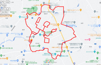
🐎 Draw a Horse with GPS Art around Kibitsu Shrine 🗻
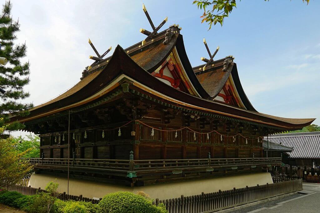
Kibitsu Shrine, one of Okayama’s most important historical shrines, is closely associated with the Momotaro legend and enshrines Kibitsuhiko-no-Mikoto. The shrine is famous for its unique architectural style and its long, straight corridor known as the Kairo, which creates a solemn and timeless atmosphere. In autumn, the shrine hosts a traditional yabusame ritual, where mounted archers demonstrate ancient martial skills, highlighting the shrine’s deep historical connection with horses.
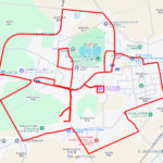
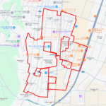
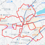
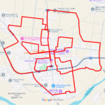
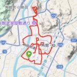
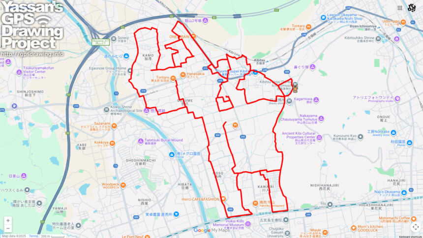
This 23km GPS art course invites walkers to draw the shape of a horse while exploring the area around Kibitsu Shrine. Starting from the shrine and its iconic corridor, the course passes Uga Shrine, the Inukai Bokudo Memorial Hall, and the ruins of Kamo Castle, offering insight into the cultural and political history of the Kibi region. The course also passes through the area around Kibitsu Station, where calm residential streets reflect the long-standing relationship between transportation and settlement in this historic land.
Geographically, the Kibitsu area lies at the northern edge of the Okayama Plain, an area that has supported agriculture and human activity since ancient times. Fertile plains and gentle hills helped the ancient Kingdom of Kibi flourish, giving rise to myths, legends, and religious traditions. Horses played a vital role in transportation, ceremonies, and warfare, and their importance is still symbolized today through rituals such as yabusame.
Walking this GPS art course allows visitors to combine physical activity with cultural discovery. Tracing the form of a horse on the map adds a symbolic layer to the journey, making it especially suitable for the New Year season. This course offers a unique way to experience Japanese mythology, history, and tradition while welcoming the year ahead with a purposeful and memorable walk.
DETAIL (EXTERNAL LINK)

A PIONEER IN GPS ART.
1st work was authorized by Guinness World Records as “the Largest GPS Drawing”.
He is the only Japanese person to be featured in a Google documentary as an innovator. He is fascinated by the idea of drawing with GPS and has published more than 2,500 works.