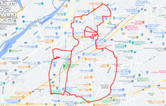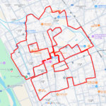
Run Through History and Nature! “Higashimurayama” GPS Art Course✨
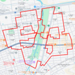
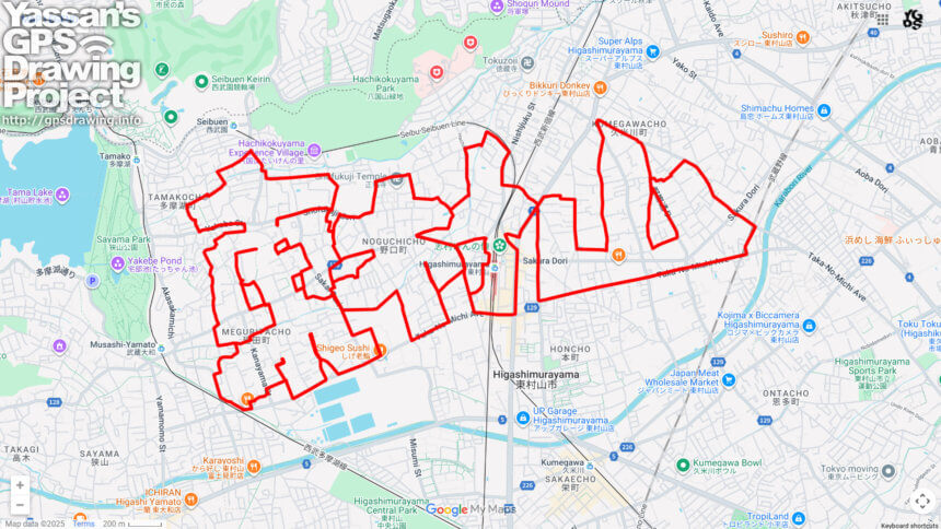
Located in the northern part of Tokyo’s Tama region, Higashimurayama is a city blessed with rich nature and deep cultural heritage. Here, a 23km GPS art course has been designed to draw the characters for “Higashimurayama.” Starting from Higashimurayama Station, the course connects key city landmarks including Musashi-Yamato Station, Seibuen Station, as well as historic sites such as Daizen-in Temple, Shofuku-ji Temple, and Kaerita Kanayama Shrine—making for a rewarding and culturally rich run.
The name “Higashimurayama” originates from its historical role as a central village (“Murayama”) in the Tama region, later distinguished with the prefix “Higashi” (East) to denote its position within Musashi Province. Today, the city retains the charm of its satoyama landscapes, with woodlands and spring water spots scattered throughout, harmonizing nature with urban life.
One of the cultural highlights is Shofuku-ji Jizodo Hall, a designated National Important Cultural Property, preserving the architectural beauty of the Muromachi period. The city is also known for its ties to popular culture—such as the famous “Higashimurayama Ondo” folk song and the beloved Seibuen Amusement Park—embodying both tradition and entertainment.
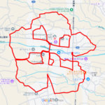
Completing this 23km course and seeing “Higashimurayama” emerge on your GPS map is a uniquely satisfying achievement. This journey offers not only the joy of GPS art but also an immersive experience of the city’s history, culture, and natural beauty.
DETAIL (EXTERNAL LINK)

A PIONEER IN GPS ART.
1st work was authorized by Guinness World Records as “the Largest GPS Drawing”.
He is the only Japanese person to be featured in a Google documentary as an innovator. He is fascinated by the idea of drawing with GPS and has published more than 2,500 works.