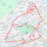
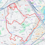
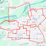
GPS art of the place name “Ageo” drawn in Ageo City✨
This is a series of GPS art courses that draw the place name “Ageo” in Ageo City, Saitama.
The origin of the place name “Ageo (上尾)” is believed to be due to its topography. The name “Ageo” is a combination of “kami (land or highland: 上)” and “o (mountain ridge: 尾)” because of its location on a plateau between the Shiba River and the Kamo River.
The area became the domain of a group of samurai during the Heian period (794-1185), and developed as Ageo Juku (inn) on the Nakasendo road during the Edo period (1603-1868). During the Meiji period (1868-1912), the city developed as a modern industrial city, and after repeated mergers, the current city of Ageo was established in 1955. The city has developed as a suburban bedroom community centering on Ageo Station.
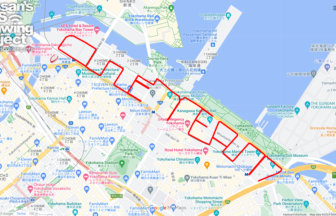
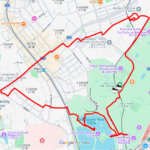
This course is a tour of the central part of the city, including Nakasendo Road, Ageo Station, and Ageo City Hall, which used to be Ageo Juku (inn). You can enjoy both the atmosphere of the former inn town and that of a modern bedroom town. We hope you will try it as part of your suburban stroll!
TOURISTS SPOT
REFFERENCE

Photo: Yassan
DETAIL (EXTERNAL LINK)

A PIONEER IN GPS ART.
1st work was authorized by Guinness World Records as “the Largest GPS Drawing”.
He is the only Japanese person to be featured in a Google documentary as an innovator. He is fascinated by the idea of drawing with GPS and has published more than 2,500 works.