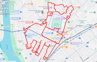
Walk Through History and Modern Life! Draw “Chūō” in the Heart of Chiba with GPS Art✨
Chūō Ward, the administrative and commercial hub of Chiba City, is a lively district that expands outward from JR Chiba Station. Here, modern skyscrapers, bustling shopping streets, and government buildings stand side by side with historic landmarks such as Chiba Shrine, a site deeply connected to the legacy of the Chiba clan. This unique blend of tradition and contemporary culture makes the area an exciting destination to explore.
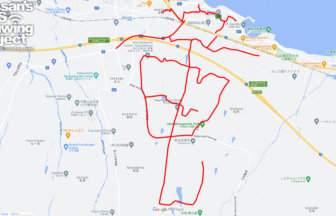
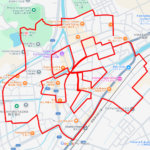
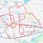
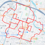
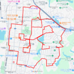
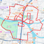
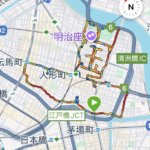
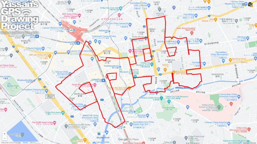
This GPS art course invites you to experience the charms of Chūō Ward while drawing the word “中央” (“Chūō,” meaning “central”) across the city map. Spanning approximately 12 kilometers, the course starts southeast of JR Chiba Station, weaving through vibrant downtown streets, the government district, quiet residential areas, and finally the historic grounds of Chiba Shrine. As you move through the course, the characters of “中央” begin to emerge on your GPS tracker, transforming your walk or run into a living artwork.
Highlights along the way include the Chiba Prefectural Government Offices, a symbol of the region’s political life, and Chūō Park, a green oasis that has long been a gathering place for local residents. Chiba Shrine, dating back to the Heian period, serves as a spiritual anchor and is renowned as the center of Hokushin Myōken worship. This combination of sacred history and modern urban dynamism gives the course its distinctive appeal.
Whether you’re sightseeing, shopping, or simply out for a stroll, this GPS art course allows you to discover new perspectives of Chiba. By the end of the 12-kilometer journey, you’ll not only have enjoyed the city’s cultural and historical richness but also created your own unique digital artwork spelling out “Chūō.”
TOURISTS SPOT
- Chiba Station
- Keisei-Chiba Station
- Chibachuo Station
- Yoshikawakoen Station
- Hon-Chiba Station
- Chiba Prefectural Government Office
- Tsukamoto Dai-Chiba Building
- Inohana Castle Ruins
- Chiba City Chuo Park
- Honcho Park
- Toricho Park
- Chiba City Museum of Science
- Chiba City Culture Center
- Chiba Shrine Myōken Hongū
REFFERENCE
DETAIL (EXTERNAL LINK)

A PIONEER IN GPS ART.
1st work was authorized by Guinness World Records as “the Largest GPS Drawing”.
He is the only Japanese person to be featured in a Google documentary as an innovator. He is fascinated by the idea of drawing with GPS and has published more than 2,500 works.