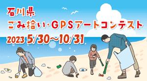
Tokyo
- Sort condition
- Newest first
- Oldest first
- Large number of views
-
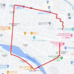
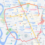
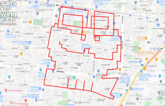
Frog in Kaeru-tachi, Chuo, Tokyo 10km
Frog GPS art on chansonniers in Ginza Corridor Street✨This is a course of frog GPS art to be drawn at Ginza "Frogs", …
-
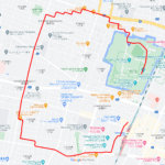
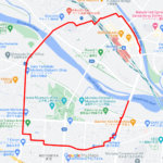
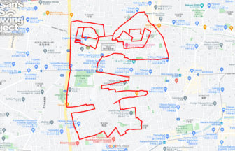
Frog in Kaeru Park, Higashimurayama, T…
Frog GPS art to be drawn in a park named after frogs✨This GPS art course is located in a quiet apartment complex and …
-

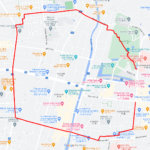
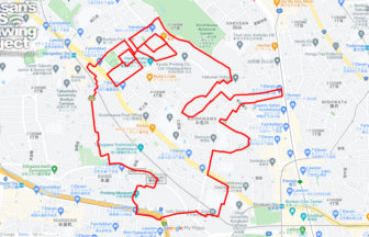
Frog in Rokugatsu Hachiman Shrine, Ada…
Frog GPS art drawn on the site where Kobayashi Issa's famous haiku was born✨This is a course of GPS art of frogs to b…
-
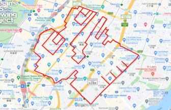
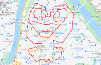
Frog in Kaeru Daimyojin, Taito, Tokyo …
Frog GPS art in a retro shopping arcade✨This is a GPS art of a frog, which is drawn on Kaeru (Frog) Daimyojin in Tori…
-
Frog in Kaeru Park, Suginami, Tokyo 11…
Frog GPS art to be drawn in a park named after a frog✨This is a course of GPS art of frogs to be drawn in "Kaeru Park…
-
Frog in Kaeru-zaka, Bunkyo, Tokyo 9km
Frog GPS art on a steep slope in Tokyo✨This is a course of GPS art of frogs to be drawn on "Kaeru-zaka (Frog Hill)", …
-
Frog in Kaeru no Tunnel, Sumida, Tokyo…
Frog GPS art drawn on a frog goods specialty store✨This is a course of GPS art of frogs drawn in the "Kaeru no Tunnel…
-
Frog in Kaeruhiroba Park, Setagaya, To…
GPS art for the rainy season, drawn in a park loved by local community✨This is a course of frog GPS art to be drawn i…
-
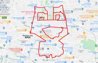
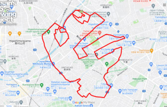
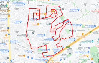
Frog in Harunokaze Park, Nerima, Tokyo…
GPS art for the rainy season, drawn in a park famous for its frog pond✨This is a course of frog GPS art to be drawn i…
-
Snail in Takahata Fudoson, Hino, Tokyo…
GPS art of snails drawn on a hydrangea spot✨This is a GPS artwork of a snail to be drawn on Takahata Fudozon, one of …