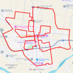
Kanto Region

Sort condition
Newest first
Oldest first
Large number of views
  1. 洗足池の"C"(東京都大田区)のGPSアート
    • Kanto RegionTokyo
    • - 10 km
    • LetterLetter/Symbol/MapOfficialWalk in Her Shoes

    “C” in Senzoku Pond, Ota W…

    GPS art on Senzoku Pond in Ota-ku, a tranquil atmosphere and is a popular place for recreation and relaxation.

  2. 古利根川の"C"(埼玉県越谷市/松伏町)のGPSアート
    • Kanto RegionSaitama
    • - 10 km
    • LetterLetter/Symbol/MapOfficialWalk in Her Shoes

    “C” in Furutone River, Kos…

    GPS artwork circles both banks of the river and creates a 7-km-long letter “C”.

  3. 印旛沼の"C"(千葉県印西市/佐倉市)のGPSアート
    • ChibaKanto Region
    • 11 - 20 km
    • LetterLetter/Symbol/MapOfficialWalk in Her Shoes

    “C” in Inba Marsh, Inzai &…

    GPS art on Inba Marsh, located on the border of Inzai City and Sakura City, one of the largest lakes in the Boso Peni…

  4. 昭和沼の"C"(埼玉県久喜市)のGPSアート
    • Kanto RegionSaitama
    • - 10 km
    • LetterLetter/Symbol/MapOfficialWalk in Her Shoes

    “C” in Showa Marsh, Kuki, …

    GPS art on Showa Marsh, a man-made swamp that was excavated to create an industrial park.

  5. 城沼の"C"(群馬県館林市)のGPSアート
    • GunmaKanto Region
    • - 10 km
    • LetterLetter/Symbol/MapOfficialWalk in Her Shoes

    “C” in Jo Marsh, Tatebayas…

    GPS artwork around Jounuma, where the waterfront and history are in harmony.

  6. レイクタウンの"C"(埼玉県越谷市)のGPSアート
    • Kanto RegionSaitama
    • - 10 km
    • LetterLetter/Symbol/MapOfficialWalk in Her Shoes

    “C” in Lake Town, Koshigay…

    GPS art in Koshigaya Lake Town, one of Japan's largest environmentally symbiotic cities.

  7. 善福寺公園の"C"(東京都杉並区)のGPSアート
    • Kanto RegionTokyo
    • - 10 km
    • LetterLetter/Symbol/MapOfficialWalk in Her Shoes

    “C” in Zenpukuji Park, Sug…

    GPS art in Zempukuji Park, an urban oasis of lush greenery, nature, and history.

  8. 北の丸公園の"C"(東京都千代田区)のGPSアート
    • Kanto RegionTokyo
    • - 10 km
    • LetterLetter/Symbol/MapOfficialWalk in Her Shoes

    “C” in Kita-no-maru Park, …

    GPS art in Kitanomaru Park, known as a vast green area that stretches to the north of Edo Castle.

  9. 清新町の"C”(東京都江戸川区)のGPSアート
    • Kanto RegionTokyo
    • - 10 km
    • LetterLetter/Symbol/MapOfficialWalk in Her Shoes

    “C” in Seishincho, Edogawa…

    GPS art in Seishin-cho, used to be a ford outside the “Kasai Coastal Levee”.

  10. 木場公園の"C"(東京都江東区)のGPSアート
    • Kanto RegionTokyo
    • - 10 km
    • LetterLetter/Symbol/MapOfficialWalk in Her Shoes

    “C” in Kiba Park, Koto War…

    GPS art in Kiba Park, that takes visitors on a walk through the history of Kiba, which prospered as a town of lumber.

  1. さらんべ公園のさくら(北海道八雲町)のGPSアート

    Cherry Blossom around Saranbe Park, Yakumo, Hokka…

  2. 猿賀公園のさくら(青森県平川市)のGPSアート

    Cherry Blossom around Saruka Park, Hirakawa, Aomo…

  3. お物見公園のさくら(岩手県奥州市)のGPSアート

    Cherry Blossom around Omonomi Park, Oshu, Iwate p…

  4. 鹽竈神社のさくら(宮城県塩竈市)のGPSアート

    Cherry Blossom around Shiogama Shrine, Shiogama, …

  5. 増田町のさくら(秋田県横手市)のGPSアート

    Cherry Blossom in Masuda, Yokote, Akita pref. 16km

  1. 上野公園のさくら(東京都台東区)のGPSアート

    Cherry Blossom in Ueno Park, Tokyo 10km

  2. 夢洲サークルウォーク(大阪市此花区)のGPSアート

    Yumeshima Circle Walk 2km

  3. Aomori-Hakodate Ferry, Aomori, Aomori Pref. 11km

  4. E.T. flying through the sky, Kita Akita, Akita Pr…

  5. ピースマーク(千葉県船橋市)のお絵かきラン

    PEACE on Finabashi, Chiba pref. 4km

ARCHIVES