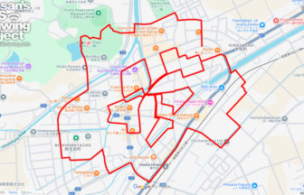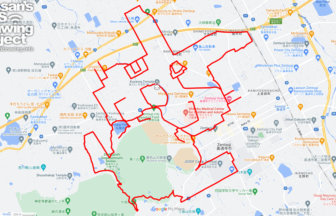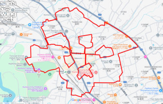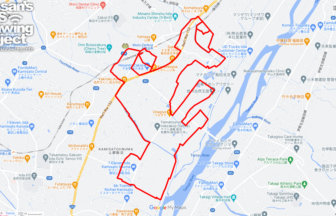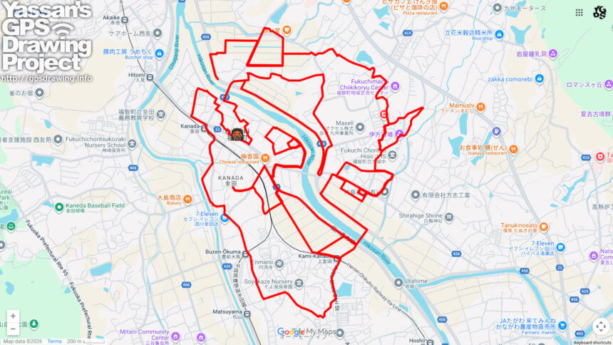
👹 Draw an Oni around Mount Fukuchi: GPS Art Journey ✨
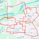
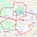
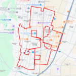
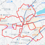
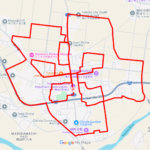
This GPS art course invites you to draw an oni (demon) while walking approximately 25 kilometers around Fukuchi Town in Fukuoka Prefecture. As you follow the course, a bold demon figure gradually appears on your map, turning a long-distance walk into an immersive journey through nature, history, and spiritual heritage.
The name “Fukuchi” comes from Mount Fukuchi, the symbolic mountain of the town. Rising to 901 meters, Mount Fukuchi has been revered since ancient times as a sacred mountain of Shugendō, a traditional Japanese mountain ascetic practice. According to tradition, it was opened in 723, and its name is believed to derive from Buddhist concepts meaning “fortune” and “wisdom.” When several towns merged in 2006, the mountain—visible from across the region—was chosen as the unifying symbol, giving birth to the name Fukuchi Town.
The course passes through key landmarks such as Fukuchi Town Hall, the Ikata Ancient Tumulus that hints at prehistoric settlement, Kaneda Inari Shrine dedicated to prosperity and harvests, and Fukuen-ji Temple, which continues to serve as a spiritual center for the community. Along the way, walkers are treated to expansive rural landscapes of the Tagawa Basin and constant views of Mount Fukuchi watching over the town.
Drawing an oni in this setting carries symbolic meaning. Protected by a mountain associated with fortune and wisdom, the demon becomes a playful guardian rather than a threat—an embodiment of driving away misfortune and welcoming good luck. This GPS art walk is ideal for the Setsubun season, but also perfect year-round for those seeking a deep, active way to experience Fukuchi’s natural beauty and cultural roots.

DETAIL (EXTERNAL LINK)

A PIONEER IN GPS ART.
1st work was authorized by Guinness World Records as “the Largest GPS Drawing”.
He is the only Japanese person to be featured in a Google documentary as an innovator. He is fascinated by the idea of drawing with GPS and has published more than 2,500 works.