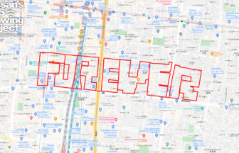
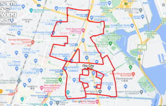
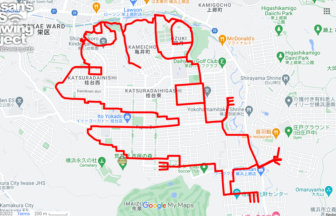
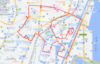
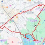
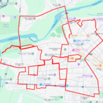
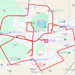
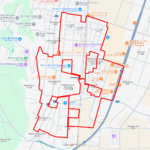
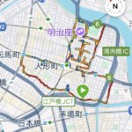
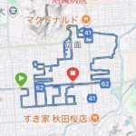
GPS art of the place name “Taito” drawn in Taito Ward✨
This is a series of GPS art courses that draw the place name “Taito” in Taito Ward, Tokyo.
Taito-ward was created in 1947 through the merger of Shimotsuya-ward and Asakusa-ward. The name of the district was not easily decided, and finally converged on the idea of “Ueno Ward” on the Shimotani Ward side and “Higashi Ward” on the Asakusa Ward side, but in the end they could not come to an agreement. In the end, the Governor’s proposal adopted “Taito-ward” as the ward name, using the word “Taito” that had been adopted by the Taito Elementary School in Shimotani Ward. The name “Taito (台東)” is a combination of the word “dai (台)” for the high plateau in Ueno and “higashi (東)” for the downtown areas of Shimotani and Asakusa, which are to the east of Ueno.
It can be drawn by cruising around downtown Asakusa. Please try it as a different sightseeing tour of Asakusa!

Source: Wikimedia Commons
DETAIL (EXTERNAL LINK)

A PIONEER IN GPS ART.
1st work was authorized by Guinness World Records as “the Largest GPS Drawing”.
He is the only Japanese person to be featured in a Google documentary as an innovator. He is fascinated by the idea of drawing with GPS and has published more than 2,500 works.