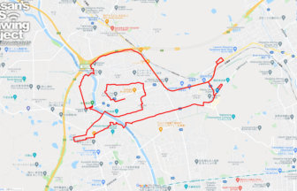
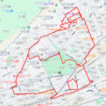
Walk the Academic City! “Kunitachi” GPS Art Course✨
Located in western Tokyo’s Tama area, Kunitachi City is a unique blend of lush residential neighborhoods and the atmosphere of an academic town. This 12km GPS art course lets you experience the city’s charm while literally drawing its name—“Kunitachi.”
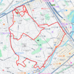
The course begins around Kunitachi City Hall and guides you past key landmarks such as Yaho Station, the historic Yaho Tenmangu Shrine, Hitotsubashi University, and the iconic postwar Kunitachi Fujimidai Apartment Complex. With each step, the distinctive character and history of the city unfolds before you.
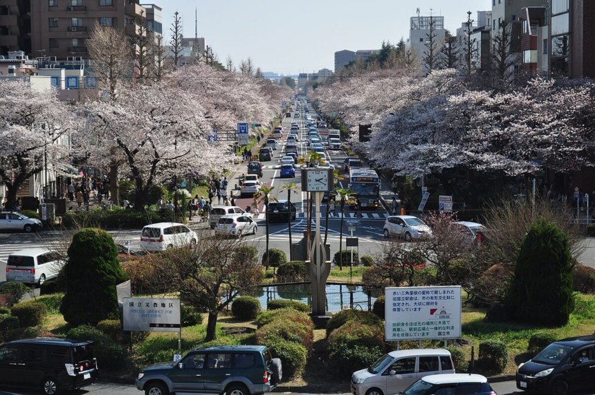
The name “Kunitachi” itself carries a fascinating origin: it was coined when this area developed as a planned academic city, situated between Kokubunji and Tachikawa—taking one character from each to form a new identity. This background reflects the spirit of modern urban planning from the Taisho to early Showa periods. Yaho Tenmangu, dedicated to Sugawara no Michizane, is one of the “Three Great Tenjin Shrines of Kanto,” attracting visitors seeking academic success. Meanwhile, Daigaku-dori Avenue, lined with cherry trees, is one of Kunitachi’s signature sights—transforming into a spectacular tunnel of blossoms every spring.
By the time you complete this 12km journey, the letters “国立 (Kunitachi)” will emerge on your GPS map. It’s a creative way to explore and rediscover the city’s serene academic atmosphere, historical depth, and harmony with nature—one step at a time.
DETAIL (EXTERNAL LINK)

A PIONEER IN GPS ART.
1st work was authorized by Guinness World Records as “the Largest GPS Drawing”.
He is the only Japanese person to be featured in a Google documentary as an innovator. He is fascinated by the idea of drawing with GPS and has published more than 2,500 works.