🐦 Through Royal Ryukyu Heritage, Historic Stone Paths, and Castle Hills 🐦
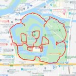
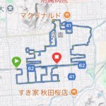
Shuri in Naha City, Okinawa Prefecture, rests atop elevated limestone hills overlooking the capital city and the ocean. For over four centuries, Shuri served as the royal capital of the Ryukyu Kingdom, functioning as the political, diplomatic, and cultural heart of Ryukyuan civilization. Characterized by iconic coral-stone ramparts, red-tiled roofs, and ancient stone roads, the district preserves a distinct cultural heritage shaped by maritime trade across East Asia. This compact 5km GPS art course invites you to experience a storied royal landscape, weaving through historic neighborhood lanes and world heritage monuments to sketch a Ptarmigan on your digital map.
The journey immerses you in Ryukyuan heritage, starting near the majestic Shuri Castle and the ceremonial Shureimon Gate, alongside the royal mausoleum of Tamaudun, a UNESCO World Heritage site. Exploring the surrounding cultural enclave, you will pass the Okinawa Prefectural University of Arts, the historic Awamori maker Zuisen Distillery Co., Ltd. Head Office, and the serene Sairaiin (Daruma Temple). The path guides you past the natural spring at Sashikasa Spring, the scenic vistas at Shuri Sakiyama Park, and the atmospheric coral limestone pathway of Shuri Kinjo Town Stone-paved Road.
Featuring gentle slopes and historic stone lanes rich in royal lore, this 5km route offers an unforgettable tour of Okinawa’s ancient capital. As the digital silhouette completes on your map, you are left with a memorable impression of Shuri’s timeless spirit.
RESTAURANTS

DETAIL (EXTERNAL LINK)

A PIONEER IN GPS ART.
1st work was authorized by Guinness World Records as “the Largest GPS Drawing”.
He is the only Japanese person to be featured in a Google documentary as an innovator. He is fascinated by the idea of drawing with GPS and has published more than 2,500 works.