🐦 Through Futuristic Skyscrapers, Cultural Theaters, and Lively Downtown Avenues 🐦
Umeda in Kita Ward, Osaka, serves as Western Japan’s largest commercial and transportation hub, affectionately known as “Kita.” Originally derived from “Umeda” (meaning “buried field”), the marshland was transformed during the Meiji era into a bustling railway gateway. Today, the district dynamically blends futuristic skyscrapers and cutting-edge urban redevelopments with historic shrines made famous by traditional puppet theater (bunraku).
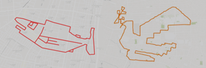
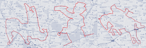
This 13km GPS art course invites you to experience a storied cityscape, weaving through modern landmarks and lively entertainment districts to sketch a Ptarmigan on your digital map.
The journey immerses you in electric urban energy, passing the iconic red Hep Five Ferris wheel, the bustling underground arcades of Hankyu Sanban Gai, and the massive transit nexus of Osaka-Umeda Station. Tracing historic alleys, you will visit Tsuyuno Shrine (Ohatsu Tenjin)—renowned for classic theatrical romance—before encountering cultural venues like Umeda Arts Theater. Moving toward the spacious green lawns of Umekita Park and the architectural marvel of the Umeda Sky Building, the route incorporates Urae Park, the prestigious The Symphony Hall, and the vibrant culinary lanes around Fukushima Station.
Featuring flat urban pavements connecting futuristic skylines with rich cultural heritage, this 13km route captures Osaka’s invigorating spirit. As the digital silhouette completes on your map, you are left with a memorable impression of this iconic metropolis.
RESTAURANTS

DETAIL (EXTERNAL LINK)

A PIONEER IN GPS ART.
1st work was authorized by Guinness World Records as “the Largest GPS Drawing”.
He is the only Japanese person to be featured in a Google documentary as an innovator. He is fascinated by the idea of drawing with GPS and has published more than 2,500 works.