🐦 Through Historic Post-Town Streets and Soccer Culture 🐦
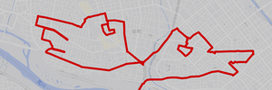
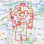
Urawa Ward in Saitama City, Saitama Prefecture, flourished during the Edo period as Urawa-shuku, the sixth post town along the historic Nakasendo Highway. Today, it stands as the prefecture’s administrative and educational heart while enjoying nationwide fame for its deep soccer heritage and historic eel culinary culture. Seamlessly blending centuries-old shrines with modern commercial hubs, Urawa offers a refined yet energetic urban atmosphere. This 10km GPS art course invites you to experience a storied cityscape, weaving through historic streets and vibrant station arcades to sketch a Ptarmigan on your digital map.
The journey immerses you in local culture, starting around the bustling transit hub of Urawa Station, the lively Urawa PARCO, and Urawa Cule. Tracing civic landmarks, you will pass the Saitama Prefectural Government Office and the welcoming Kobaton Cafe. Exploring the dynamic neighborhood avenues, the path leads near Riki, the famous pub beloved by local soccer supporters, alongside charming spots like RAFU, Kagetsu, and the serene grounds of Motobutohikawa Shrine and Enmeiji Temple. The route culminates near Tsukinomiya Shrine, renowned for its unique rabbit guardians instead of traditional stone lions.
Featuring flat, easily walkable streets filled with historic post-town charm and soccer passion, this 10km route captures Urawa’s captivating spirit. As the digital silhouette completes on your map, you are left with a memorable impression of Saitama’s historic capital center.
RESTAURANTS

DETAIL (EXTERNAL LINK)

A PIONEER IN GPS ART.
1st work was authorized by Guinness World Records as “the Largest GPS Drawing”.
He is the only Japanese person to be featured in a Google documentary as an innovator. He is fascinated by the idea of drawing with GPS and has published more than 2,500 works.