🐦 Through Historic Castle Ramparts, French Mansions, and Stroll Gardens 🐦
Tottori City in Tottori Prefecture, located at the eastern edge of the Tottori Plain facing the Sea of Japan, developed as a powerful 320,000-koku feudal castle town during the Edo period. Nestled at the base of Mount Kyusho (263m), the district is renowned for the dramatic history of Tottori Castle—famously besieged by Toyotomi Hideyoshi in the 16th century—and features a unique fortification combining mountain ridges with flatland stone walls. Today, the compact city center seamlessly integrates samurai heritage, Meiji-era French Renaissance architecture, and charming cultural museums.
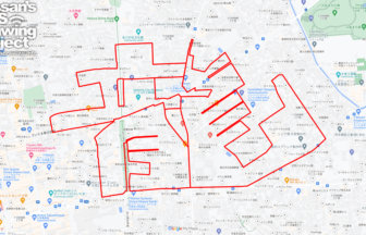
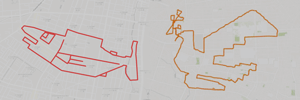
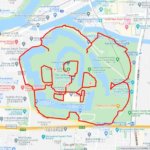
This 9km GPS art course invites you to experience a storied landscape, weaving through historic ruins and serene gardens to sketch a Ptarmigan on your digital map.
The journey immerses you in rich regional history, starting near the majestic stone ramparts of the Tottori Castle Ruins, the elegant white-timbered Jinpukaku Mansion, and the informative exhibits at the Tottori Prefectural Museum. Tracing downtown avenues, you will pass the administrative center at the Tottori Prefectural Government Office, the civic halls of Torigin Culture Hall, and the main transit hub at Tottori Station. Exploring local culture, the route leads past the nostalgic toy and nursery rhyme exhibits at WarabeKan before reaching the exquisite Edo-period stroll garden at Kannon-in Garden.
Featuring flat, accessible city streets wrapped in castle town heritage, this 9km route captures Tottori’s enduring charm. As the digital silhouette completes on your map, you are left with a memorable impression of this San’in historic enclave.
RESTAURANTS

DETAIL (EXTERNAL LINK)

A PIONEER IN GPS ART.
1st work was authorized by Guinness World Records as “the Largest GPS Drawing”.
He is the only Japanese person to be featured in a Google documentary as an innovator. He is fascinated by the idea of drawing with GPS and has published more than 2,500 works.